Anthropogenic Influences
Initial Shoreline Modifications
The shore was once in a more natural state. The initial anthropogenic modification of the shoreline began with creating piers to allow sailing ships, with their large keels to dock on shore. Shortly after, Stone Hooking began where loose rock from beaches and shallow waters was easily gathered and delivered to shipping and construction companies. This industry grew to a maximum in the 1830's, where they removed as much as 43,000 tonnes of stone annually. This was the initial removal of the natural armor that protected the shorelines and lake bottom. With the loss of the smooth depth gradient approaching the shore, the waves were able to disipate their energy closer to shore, and with more vigorous fury.
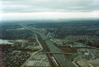
Figure 27 : Urbanization
Overlooking Pickering/Scarborough, and Duffrin's Creek
|
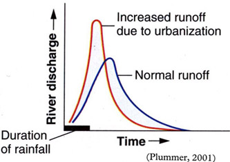
Figure 28 : Urban Versus Normal Runoff
River Discharge Over Time
|
Large amounts of development have occured all around the Great Lakes over the past few centuries. With this development, comes an urbanized landscape. This new landscape, has a negative effect on the lakes. The most notorious of these effects, is urban runoff. With a mostly paved surface, the infiltration capacity of the soil is dramatically reduced. With low infiltration capacity, Horton Overland Flow can occur, carrying water enriched with sediment across the surface and off site. The response time of the streamflow in an urbanized basin is increased, where the volume of water per unit time will reach a greater maximum, and increasing the erosion potential of the stream.
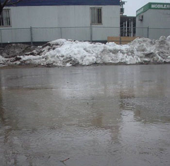
Figure 29 : Construction Site
Puddle Filled With Sediment
|
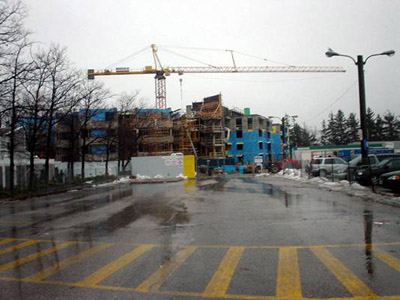
Figure 30 : Construction Site
A more recognizable view - UTSC Campus
|
Construction sites are often cited as a major contributor of sediment due to their uncovering of natural protective layers of soil. By law, the construction sites must attempt to retain the soil that is uncovered, but often, the protective measures are inadequate. The protection measures are usually two feet high fencing around a site. This fencing is often not entirely around a site, nor does it alleviate the problem of sands blowing away from the site by wind.
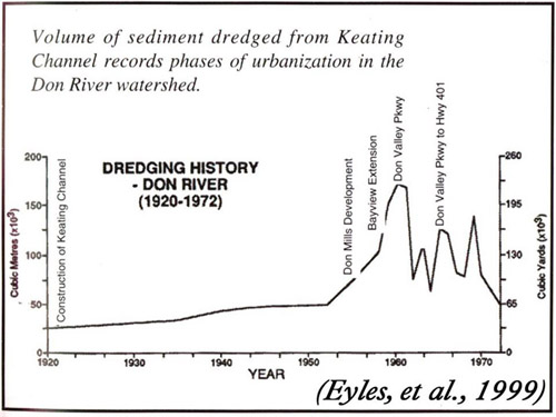
Figure 31 : Volume of Sediment Dredged From The Mouth Of The Don River
Periods of development near the Don Watershed, produce abnormally large amounts of dredging patterns. This is a good indication of the amount of sediment that entered in a particular year.
Lakefilling
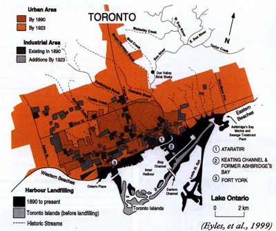
Figure 32 : Toronto Shore Development
|
Toronto Shoreline
Low shore that originally had beaches along the entire length. The Toronto Island was created by sand from the Scarborough Bluffs and sediment discharged from the Don River, and is now protected by breakwaters and seawalls and the Leslie St. Spit. The Leslie St. Spit is a lakefilled area made up of fill from construction sites, and from Subway tunnels. Dredging used to maintain the Eastern shipping channel cuts off the natural supply of beach materials to the Island
|
Lakefilling - Hamilton Harbor
The Hamilton Harbor has had large amounts of lakefill material added to it, to extend the usable area for shipping facilities. Lakefilling was also used to create a breakwall in front of the harbor, to reduce the waves.
Negative Impacts of Lakefilling
Lakefilling has many negative impacts on the lake. Materials used for fill have contributed to contamination and turbidity of the water, as not all material remains at the site. Disposal of waste materials from construction and excavation, including that judged not suitable for lakefill is sometimes used for lakefill, without the overseeing body knowing exactly where it was put, and what was contained. Generally there is an extreme lack of standards for lakefilling methods and structural designs
|
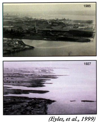
Figure 33 : Hamilton Harbor Lakefilling
|
|