
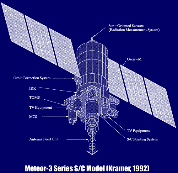
Satellites
The first weather satellite was TIROS-1 (Television and Infrared Observation Satellite), and was launched April 1st, 1960. There were previous atmospheric monitoring devices lauched, but were either short term or non-specialized meteoroloigcal satellites. (Barrett, 1999) Over twenty meteorological satellite familys exist [ click here ]. Utilizing computers satellite systems are highly automated and can scan the atmosphere in one, two or three directions. Elusive parameters, such as the momentum flux and the spectrum of atmospheric turbulence can be recorded. (Campbell, 1996)
Satellites offer weather data at a global scale, reducing the requirement of for ground stations. Many locations of the world are difficult to travel to, or are potentially hazardous. The cost of setting up ground stations, and the expense of equipment for each station impedes the number of ground stations. Another key benefit to satellite systems is that they aid in the interpolation of data. Ground stations provide spatially distant values and much variation occurs between stations. Satellite sensing allows for continuous values of measure between stations, rather than having to interpolate data values between sites. Also calibration of instruments between sites is required for better data, which offers more complete studies and adds to the validity of any models derived due to increased completeness.
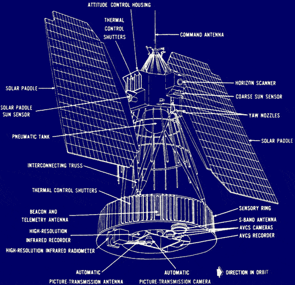
Numbus meteorological satellite. (Miller et al., 1970)
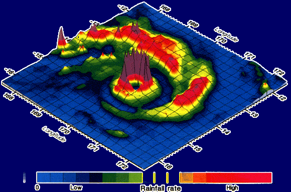
A perspective 3D view of the field of rain rates associated with Cyclone Susan over the western South Pacific on January 5th, 1998, constructed from the TMI (TRMM Microwave Imager) on the NASA/NASDA TRMM satellite. (Courtesy, Dr C. Kidd, USRA/NASA & CRS, University of Bristol.)(Barrett, et al., 1999)